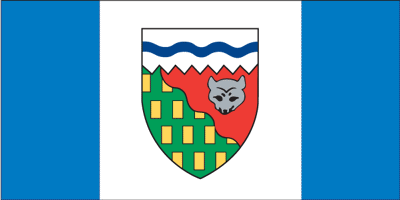
Northwest Territories
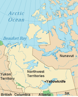
The Northwest Territories cover an area about the size of Texas or Alaska. Sunset and sunrise merge midsummer; north of the Arctic Circle, they don't occur at all. In autumn the northern lights, known as Aurora Borealis, can be seen in the sky. The barren, rock-strewn tundra of the Northwest Territories is sparsely inhabited, and many still support themselves by hunting, fishing, and trapping. People are greatly outnumbered by the population of bears, mountain sheep, wolves, moose and bison that freely wander the tundra. Yellowknife and Inuvit are the two largest communities in the Northwest Territories, mainly used as bases for travelers. The other communities, inhabited by the Dene, Metis, Inuit, and Inuvialuit, are extremely small. Native languages are spoken here, as well as English and French. There are many festivals and ceremonies which the locals will gladly welcome any visitors to attend. The Northwest Territories are bordered on the east by Nunavut, on the west by Yukon Territory, on the north by Beaufort Bay and the Arctic Ocean, and on the south by British Columbia, Alberta, and Saskatchewan. Recreational activities in the Northwest Territories include hiking, camping, canoeing, and snowmobiling. Exploring much of the Northwest Territories is truly an expedition. It is important to keep in mind that when traveling through the Northwest Territories, that much of the landscape can be treacherous during certain parts of the year and remote parts may only be accessible by plane, if at all. Northwest Territories Government LinksNorthwest Territories Tourism Links
Copyright © 2006-2025 Canada-Maps.org.
All rights reserved. Canada Maps - Northwest Territories |